Contacts:
Eastcote Conservation Panel – Contact Lesley Crowcroft – 020 8866 8436 – lesley.crowcroft@gmail.com
Friends of Eastcote House Gardens
Eastcote is most fortunate in having extensive parks and green spaces, woodland areas, a large number of historic buildings, Conservation Areas and a number of Sites of Importance for Nature Conservation (SINC).
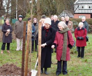
Under the heading of Conservation in Eastcote are a whole range of activities connected with the protection and enhancement of our local environment. Local members who are involved in Conservation are drawn from all areas of the Community with diverse interests in local history, plants and trees, preservation of buildings. Through members of the Residents Association, members of the Conservation Panel and Friends groups we help to look after and monitor activity in the following:-
- Four Parks :-
Eastcote House Gardens: 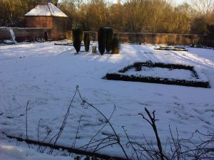
Walled Garden – Winter 2010 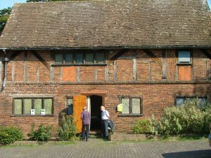
Stables Warrender Park: Haydon Hall Park: 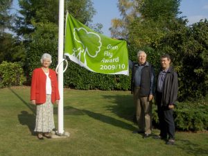
Warrender Park – Green Flag Award 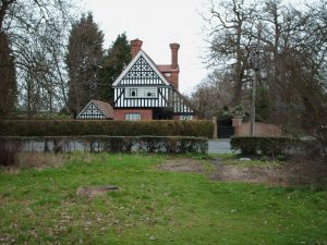
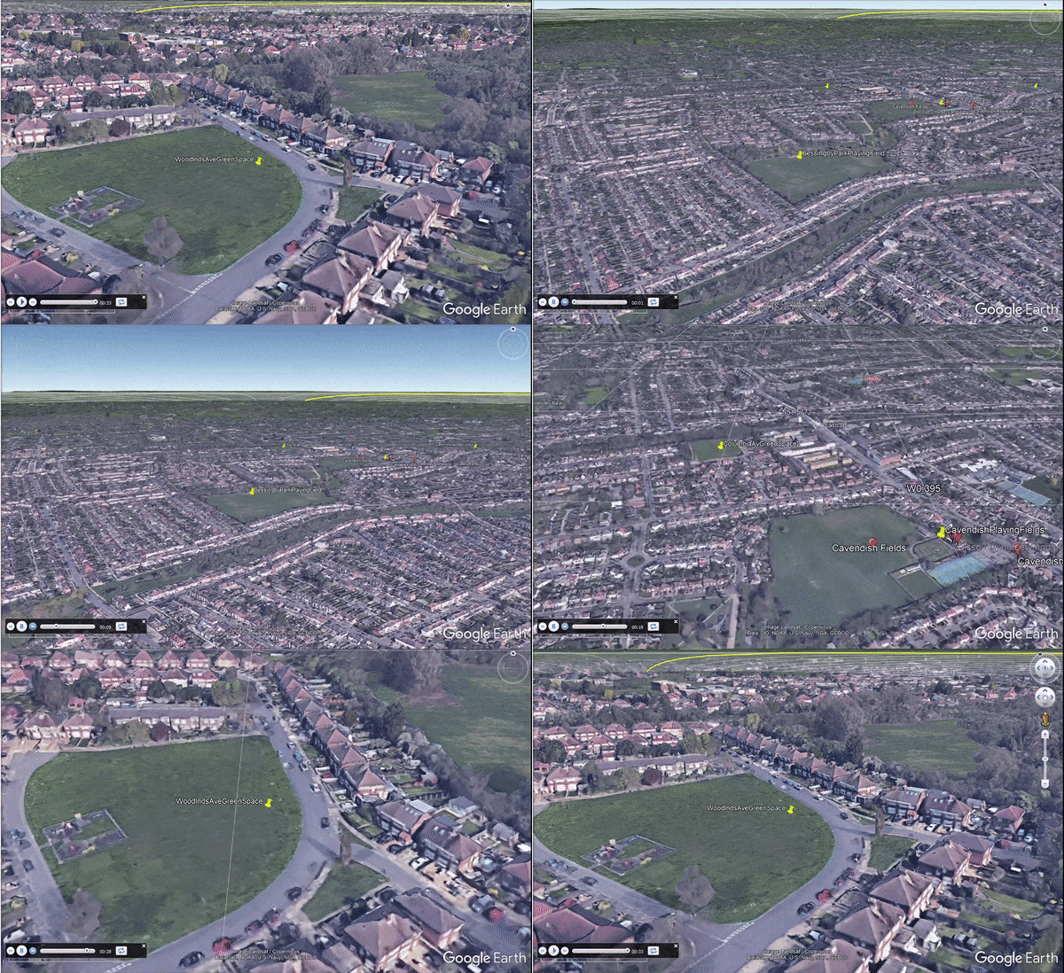
Haydon Hall Park- Haydon Hall Lodge: Bessingby/Cavendish Parks: which includes a Site of Nature Conservation 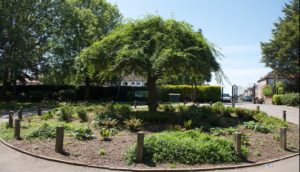
Bessingby Park 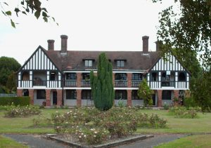
Cavendish Pavillion: - Four other Sites of Importance for Nature Conservation, ( SINC)
|
|
|
- Highgrove Woods
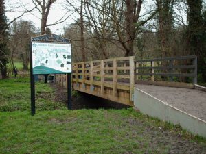
- Yeading Brook River Corridor at Whitby Road to Field End Road
Three Conservation Areas (see the Conservation Appraisals at Conservation-areas-in-Hillingdon )
1. Eastcote Village Conservation Area:
-
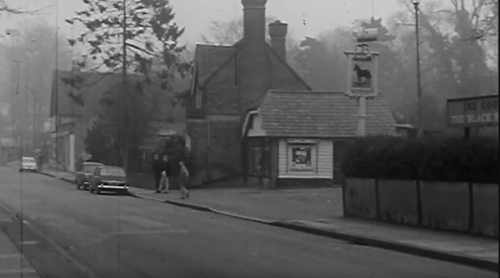
Fig 2 Land Next To Black Horse Pub 1960. A ‘still picture’ from the film ‘Ruislip – Northwood U.D.C short film of a car journey, showing old houses and newer developments’ from londonarchives.com 2. Morford Way Conservation Area
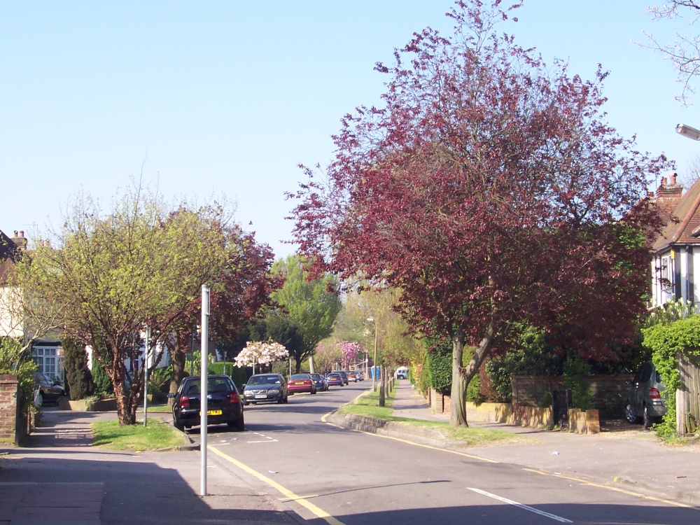
30 Grade II Listed Buildings
22 Locally listed buildings and artefacts.
The Conservation Panel or to give it its full title the Eastcote Village Conservation Area Advisory Panel through representatives is allowed to speak at North Planning Committee meetings, when applications are submitted which might affect Conservation Areas; both built environment and green spaces.
For three of the Parks local residents have formed up groups to help to look after the parks. These are:-
The Friends of Eastcote House Gardens Management Advisory Group, with members from the Conservation panel. The aim of the “Friends” is to secure the future of the Stables, Dovecote and Garden Wall, which are all on the English Heritage “Buildings at Risk Register”. In addition “The Friends” gardeners have worked tirelessly to improve the gardens.
Cavendish & Bessingby Management Advisory Group who’s aim is to improve these parks and arrange activities in the parks
Representatives of the Panel attend the meetings of Friends of Warrender Park and Highgrove Management Advisory Group, Bessingby/ Cavendish Management Advisory Group and the Yeading Valley Working Group.
For the Contacts with each of these organisations please see above
In the book – The Development of the English Semi-detached House: 1750-1950 By PAMELA B LOFTHOUSE 2012 it says ‘the Housing Act 1923 offered some subsidies and incentives to speculative builders to build new estates. And as Alan Jackson (1991) describes in his book about suburban London, the massive expansion of the tram, railway and underground networks made it possible to live in a suburb and commute to work in the city. Suburbs of semis which were accessible by the London Metropolitan trains were known as Metroland (Figure 1).
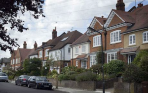
This combination of factors was a catalyst for a building boom which created countless new English interwar suburbs surrounding the cities and towns. Activity reached a peak during the late 1920s and early 1930s, a period when the speculative builders undertook every aspect of suburban estate development, “from the initial purchase and layout of the land, to marketing the houses and encouraging the maximum number of potential buyers” (Barrett and Phillips 1987, 20). Of the four million houses built during the interwar period, almost three quarters were constructed by private builders, with around 400,000 of those attracting a state subsidy (Jensen 2007, 150). Of the 2.9 million privately-built dwellings, 2.5 million were semis (Clapson 2008, 155).’
Further reading around this subject can also be found at Alan Crisp M.Litt Oxford Thesis 1998

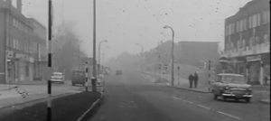
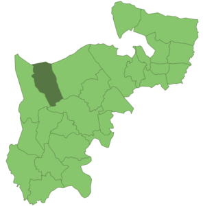
⇐Before the formation of the London Borough of Hillingdon, the area was made up of several districts one of which was the Ruislip-Northwood U.D.C (Urban District Council). For a circa 1960s short film of a car journey through the RNUDC area, showing old houses and new developments see Fig 3.
⇒Ruislip-Northwood was an urban district in west Middlesex, England, from 1904 to 1965. Fig 4 shows the extent. The district formation and abolition in 1965 is described at wikipedia RN UDC
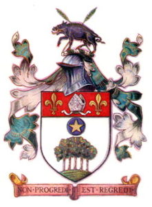
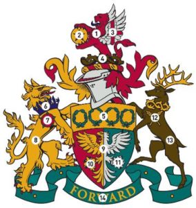
⇐ The district Coat-of-Arms was granted in 1937 The Ruislip and Northwood Urban District Council (RNUDC) Coat-of-Arms is shown in Fig 5 is explained at civicheraldry.co.uk
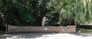
⇒The RNUDC exists now only in documention but there is a physical trace still remaining. A bridge over the River Pinn at Fore St Eastcote has a rectangular bordered stone slab inset into the wall brickwork on both sides shown in Fig 6. On researching LBHillingdon’s Archives, there is a photo with description ‘…. Black and white photograph of the Ruislip and Northwood Urban District Council coat of arms on the bridge over the River Pinn in Fore Street, Eastcote The photograph shows a coat of arms on a concrete block set into the brickwork of a bridge.Object number EAS&P 133 ….’ This is shown in Fig 7. The shape and outline of the arms of the photo in Fig 7 can just be made out match the artwork in Fig 5. edithsstreets.blogspot reviews the river-pinn-eastcote and also edithsstreets.blogspot reviews eastcote further south.
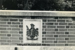
Are there any clues or coincidences for a Coat-of-Arms for this location?
It is hard to see in the black and white photo but we know from Fig 5 that the upper part of shield in the RNUDC Coat-of-Arms has 2 Fleur-De-Lys and these originate from the Medieval Landlords of this area. Wiki Heraldry Marshalling explains where two or more coats of arms is to combine them in one shield in order to express inheritance or claims to property with wiki dividing the field in this case party per fess (the shield halved horizontally).
One Fleur de Lys refers to THE ABBEY OF BEC. ( refs; google books The History of the Royal Abbey of Bec: By Jean Bourget in 1764) ‘THE monastery of Le Bec Hel- louin, or Helium, situate in Le Roumois, between Lieuvain and the plain of Neufmoury, nine leagues (lieue in French and could be any one of according to wiki Units_of_measurement_before_the_French_Revolution lieue des Postes/lieue de 25 au degré/lieue tarifaire but most likely the lieue de Paris and 25.5 imperial miles or 41.1 metric kilometres by foot) from the capital of Normandy, may justly be considered as one of the most considerable in the kingdom’.
P.118 books.google or p.118 ebooks.google says ‘The other two seals had Herlvinvs abbas: reverse the figure of a religious with a pastoral staff and book ; and on his right hand a fleur de lis, the arms of France’.
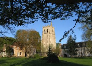

This work is licensed under a Creative Commons Attribution-ShareAlike 3.0 Unported License.
The Abbey Of Bec is of significance to England as wiki Bec_Abbey explains; the followers of William the Conqueror supported the abbey, enriching it with extensive properties in England. St Neots Priory, Goldcliff Priory in Monmouthshire, the village of Tooting Bec (now a London suburb) so named because the abbey owned the land. Persons of interest included and who both became Archbishop of Canterbury were Lanfranc (1070) and Anselm (1093). Prior Lanfranc as heritage-history explains was busy in Rome, striving for a more favourable verdict from the reigning Pope concerning the marriage of Duke William and Matilda. William gave Ducal protection to nobal families says at Abbey of Le Becs (11th–13th Centuries) edited by Pohl/Gathagan and Ernulf de Hesdin says at rnelhs ManorFarmTimeline the manor of RUISLIP was c. 1087 granted it to the Abbot and Convent of the Benedictine Abbey of Bec in Normandy. Bec enjoyed possession until 1211 when King John sequestrated as british-history middx explains. Whilst under the then Abbot Anselm, Bec became the foremost seat of learning in Europe and the fame of the monastery grew from his intellectual achievements. Research material and notes are located at the rnelhs Medieval Bibliography.
Whilst wiki Bec_Abbey points out that “Bec” is the name of the stream running through the abbey.
The other Fleur de Lys of the RNUDC Coat-of-Arms can be seen in the Arms of Cambridge College at Wiki CollegeCambridge. The source kings.cam.ac.uk/archive-centre confirms that rectorial manors came with chancel repair liability and BritishHistory Ruislip goes onto explains that ‘….the bridge, responsibility for which had been transferred to the lord of the manor, was again ruinous….A brick and timber structure, maintained at the expense of King’s College, Cambridge as lords of the manor, …The college was also responsible for the upkeep of Cannons’ Bridge and Parson’s Bridge in Bury Street and a wooden bridge at White Butts … responsibility for Clack Bridge across the Pinn at the west end of Clack Lane near the western boundary….All these were cart bridges, the parish being responsible for repairs to numerous foot bridges’. Here at kings.cam.ac.uk is the oldest known complete manorial court roll in existence and includes Tooting, Surrey and Ruislip. Kings College also holds a Middlesex 6″ Ordnance Survey Map of the Ruislip Manor Estate showing property owned by the College in 1894.
Fore Street bridge may have been present in 1841 by inspection of the map at this archive; Middlesex X.NW Nat. Lib. Scotland.
rnelhs The ManorFarmTimeline explains that Fore Street (taking its name from its position in front of the park) is in the Domesday Book .
The stream at the Abbey of Bec Normandy and the bridge maintenance of Kings College Cambridge is hence apt that a coat of arms be on a bridge over the Pinn river.
The abolition of RNUDC in 1965 perhaps initiated the removal the Coat-of-Arms and its deux fleurs from Fore St bridge and perhaps removes a link to this fair land and 800 years of history including one Abbey, two Archbishops, a Conqueror and their English land expropriations and England’s King’s College Cambridge as lords of the manor from 1611 to c. 1758.
Local people do remember. ‘…there was a plaque on the Fore Street bridge which I recall seeing many years ago. You can still see where it used to be….‘
|
|
|

.
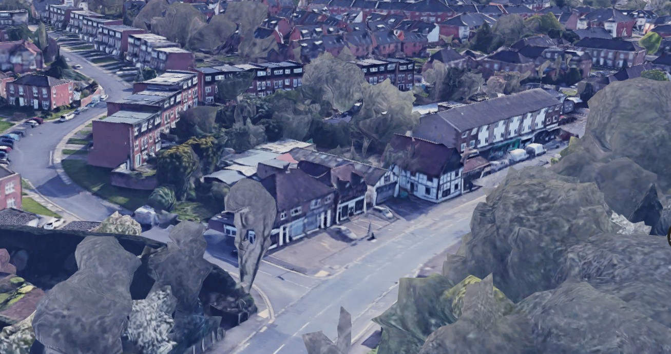
Parks And Green Spaces in South Eastcote
