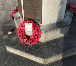
 The Tributes planted in our Fields of Remembrance each carry a personal message to someone who lost their life in Service for our country.
Every year we take great care and attention in planting thousands of personal Tributes made by members of the public throughout the UK. This year will be no different and we are determined that COVID-19 will not stop us honouring those who sacrificed so much for us all.
You can support the Poppy Appeal by text or scan:
To donate £2 text POPPY2 to 70545 *
To donate £5 text POPPY5 to 70545 *
To donate £10 text POPPY10 to 70545 *
You will be charged £2, £5, or £10 plus one message at your standard network rate. The Royal British Legion will receive 100%. We will contact you by text on the mobile number you used to give you the opportunity to let us know how you would like to be contacted in the future and to find out whether you would like to add Gift Aid to your donation.
Dedicate A Tribute
This year, we are also launching our virtual Field of Remembrance, where you can virtually plant your Tribute from home, and explore other Tributes made to remember the fallen. To dedicate a tribute in 2020:
Complete The Online Form at: https://mcas-proxyweb.eu.cas.ms/certificate-checker?login=false&originalUrl=https%3A%2F%2Fdonations.britishlegion.org.uk.eu.cas.ms%2Flrx%2F
Choose Your Tribute Type
Leave a personal message
Choose the Field of Remembrance where you want your Tribute to be planted, and you can also choose to add your Tribute to our Virtual Field of Remembrance
Visit Our Virtual Field Of Remembrance
Remember and honour the fallen by leaving a Tribute in our virtual Field of Remembrance. This year, you can virtually plant your Tribute from the comfort of your home.
Row upon row of Tributes with their scarlet poppies, personal messages and photographs bring home to all of us that Remembrance is a deeply important and personal event.
While it is our current hope to plant Tributes in the same way as we have done for over 90 years, if location or national restrictions are in place which means this is not possible, we will plant your Tribute in another Field or on our virtual Field of Remembrance.
For any queries please email dedicate@britishlegion.org.uk or call us on 0345 845 1945.
Create Your Tribute
Your Tribute and donation will help to support members of the Armed Forces community. During these current challenging and difficult times, we need your help more than ever.
Visiting The Fields Of Remembrance
Each November, we welcome members of the public from across the UK, to join us and honour the memory of loved ones who we have sadly lost, serving in our Armed Forces.
The Fields of Remembrance are officially opened with a special Remembrance service where we honour The Two Minute Silence at 11.00 am.
A bugler plays the Last Post and the Exhortation is read. All the fields are open during daylight hours. Due to the current restrictions, we have made the difficult decision to close all of our opening services to protect the public, staff, and volunteers.
All Fields will be open after the Service from 1.00 pm. Please note that on 11 November (Armistice Day), the Fields can be very crowded.
Find out more about each of the Fields of Remembrance and their location:
https://www.britishlegion.org.uk/get-involved/ways-to-give/remember-a-loved-one/fields-of-remembrance
via
Jeff Duley
Eastcote Royal British Legion Branch Chairman & Membership Secretary
 Signup here to virtual events to find out more about HS2 works in Hillingdon